
Digital twins are revolutionizing how we design, monitor, and manage physical assets and environments. At their core, digital twins are virtual replicas of physical objects, processes, or systems that are updated with real-time data. When combined with geospatial technology, digital twins become even more powerful, offering detailed, location-based insights that drive smarter decisions across industries.
What Are Digital Twins?
A digital twin is a dynamic, digital representation of a real-world entity. It can be anything from a single machine to an entire city. The key advantage of a digital twin is its ability to mirror the current state of its physical counterpart by integrating data from sensors, IoT devices, and other sources. This allows stakeholders to analyze performance, predict outcomes, and optimize operations without direct physical intervention.
The Role of Geospatial Technology
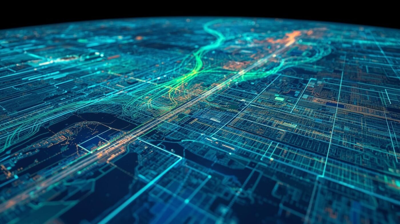
Geospatial technology refers to tools and techniques that collect, analyze, and visualize data linked to specific locations on Earth. This includes Geographic Information Systems (GIS), remote sensing, GPS, and mapping software. When geospatial data is layered into a digital twin, it provides context about where assets are located, how they interact with their environment, and how spatial factors influence their behavior.
For example, in urban planning, integrating geospatial data with digital twins enables planners to visualize how new infrastructure will impact traffic flow, green spaces, and utility networks. In agriculture, geospatial-enabled digital twins can monitor crop health, predict yields, and optimize irrigation based on precise field locations.
Benefits of Combining Digital Twins and Geospatial Technology
1. Enhanced Visualization: Geospatial data provides accurate maps and 3D models, making digital twins more intuitive and actionable.
2. Real-Time Monitoring: Sensors and IoT devices feed live geospatial data into digital twins, enabling instant awareness of changes or issues.
3. Predictive Analytics: By analyzing spatial patterns and historical data, organizations can forecast trends and plan proactively.
4. Improved Collaboration: Interactive digital twins with geospatial layers make it easier for teams to share insights and coordinate responses.
Real-World Applications
– Smart Cities: Cities use digital twins with geospatial data to manage utilities, transportation, and emergency response more efficiently.
– Infrastructure Management: Asset managers monitor bridges, roads, and pipelines in real time, identifying maintenance needs before they become critical.
– Environmental Monitoring: Digital twins track air quality, water resources, and land use changes, supporting sustainability initiatives.
Getting Started
To build a digital twin with geospatial technology, start by identifying the physical assets or processes to model. Gather geospatial data through surveys, drones, or satellite imagery. Next, select a platform that supports both digital twin modeling and geospatial integration—many GIS platforms now offer digital twin capabilities. Finally, connect real-time data sources to keep your digital twin updated and relevant.
Conclusion
Digital twins powered by geospatial technology are transforming industries by providing deeper insights, better predictions, and more efficient operations. As these technologies continue to evolve, their integration will unlock new possibilities for innovation and smarter decision-making.