
Geospatial Solutions in Agriculture: Revolutionizing Modern Farming
The agricultural sector has always been the backbone of human civilization, providing food, raw materials, and livelihoods for billions of people. In recent years, the world has witnessed a technological revolution in agriculture, with geospatial solutions playing a pivotal role. These advanced tools and techniques are transforming traditional farming into a data-driven, efficient, and sustainable enterprise. In this article, we’ll explore what geospatial solutions are, how they are applied in agriculture, their benefits, and the future they promise for global food security.
What Are Geospatial Solutions?
Geospatial solutions refer to technologies that collect, analyze, and visualize data related to the Earth’s surface and its features. They include tools such as Geographic Information Systems (GIS), Global Positioning System (GPS), remote sensing (satellite and drone imagery), and spatial data analytics. These technologies allow users to capture precise information about locations, patterns, and changes across large areas, making them invaluable in sectors that depend on land, such as agriculture.
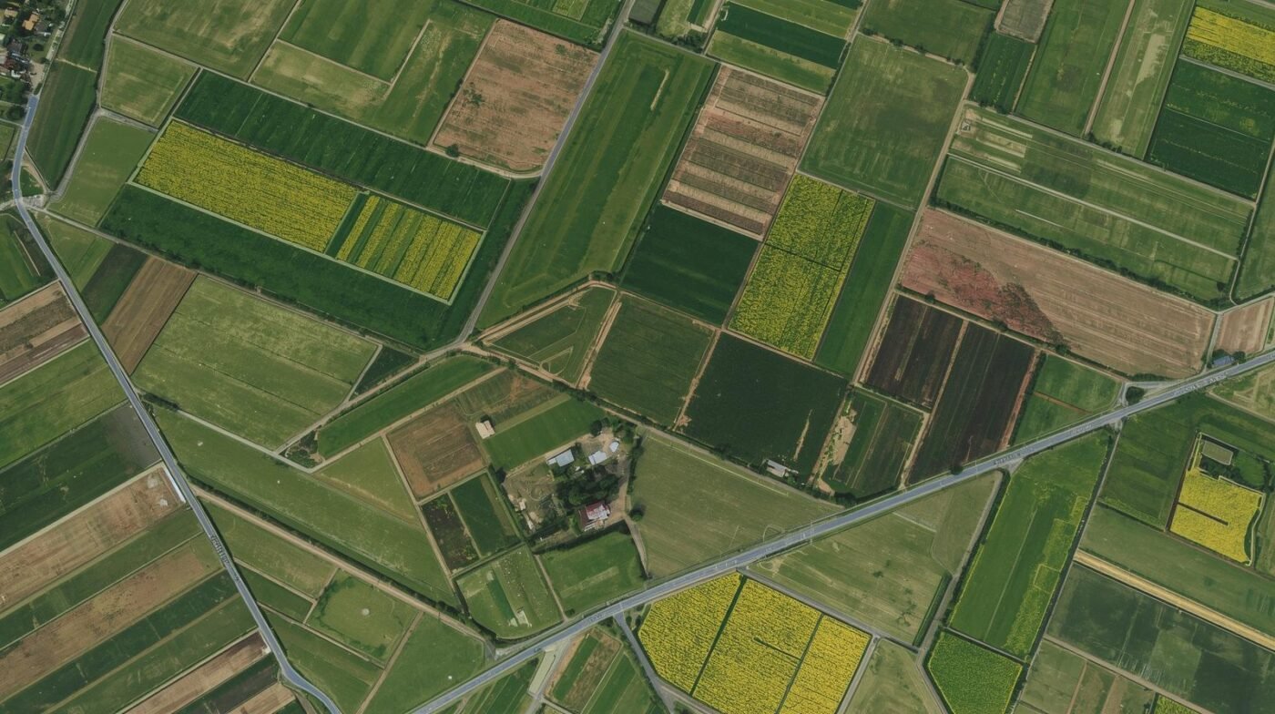
Applications of Geospatial Solutions in Agriculture 1. Precision Agriculture
One of the most significant impacts of geospatial technology is in precision agriculture. Precision agriculture involves managing variations in the field to increase crop yield and reduce waste. By using GPS and GIS, farmers can create detailed maps of their fields, identifying differences in soil type, moisture, and nutrient levels. This enables targeted application of water, fertilizers, and pesticides, ensuring that each part of the field receives exactly what it needs.
For example, GPS-guided tractors can plant seeds at optimal depths and spacing, while variable-rate technology (VRT) can adjust the amount of fertilizer applied in real-time based on spatial data. This reduces input costs, minimizes environmental impact, and boosts productivity.
2. Crop Monitoring and Health Assessment
Remote sensing, through satellites or drones, provides farmers with timely and accurate information about crop health. By analyzing multispectral and hyperspectral images, farmers can detect issues like disease, pest infestations, or nutrient deficiencies before they become visible to the naked eye. This early detection allows for prompt intervention, reducing crop losses and improving overall yield.
Normalized Difference Vegetation Index (NDVI) maps, generated using satellite imagery, are commonly used to assess plant health and vigor. These maps highlight areas of stress in the field, guiding farmers to investigate and address specific problems.
3. Soil Analysis and Mapping
Soil is the foundation of agriculture, and understanding its properties is crucial for successful farming. Geospatial technologies enable detailed soil mapping, revealing variations in texture, structure, organic matter, and moisture content. By integrating soil data with GIS, farmers can make informed decisions about crop selection, irrigation scheduling, and land management practices.
Soil sampling, combined with GPS coordinates, ensures that samples are collected systematically and results are accurately mapped. This data-driven approach helps optimize soil fertility and prevent degradation.
4. Irrigation Management
Water scarcity is a major challenge in many agricultural regions. Geospatial solutions help farmers use water more efficiently by monitoring soil moisture levels, weather patterns, and crop water needs. Remote sensing can identify areas of the field that are too dry or too wet, allowing for precise irrigation.
GIS-based irrigation planning tools can design optimal irrigation layouts, reducing water waste and energy consumption. Smart irrigation systems, connected to sensors and GPS, can automatically adjust water delivery based on real-time data.
5. Yield Prediction and Forecasting
Accurate yield prediction is essential for planning harvests, storage, and marketing. Geospatial data, combined with machine learning algorithms, can analyze historical trends, weather data, and crop conditions to forecast yields. This information helps farmers and agribusinesses make better decisions about resource allocation and market strategies.
6. Land Use and Environmental Monitoring
Geospatial tools are also used to monitor land use changes, deforestation, and environmental impacts of agriculture. By tracking land cover over time, policymakers and farmers can assess the sustainability of agricultural practices and implement measures to protect ecosystems.
Benefits of Geospatial Solutions in Agriculture
The integration of geospatial solutions into agriculture brings several key benefits:
- Increased Productivity: By optimizing inputs and identifying problems early, farmers can achieve higher yields and better quality crops.
- Cost Savings: Precision application of resources reduces waste and lowers input costs for fertilizers, pesticides, and water.
- Sustainability: Efficient use of resources and reduced chemical runoff contribute to environmental protection and long-term soil health.
- Risk Management: Early detection of threats and accurate forecasting help farmers mitigate risks from pests, diseases, and adverse weather.
- Data-Driven Decisions: Access to real-time, location-specific data empowers farmers to make informed management choices.
Real-World Examples
- India: The Indian government’s use of satellite imagery for crop forecasting has improved food security planning and disaster response.
- United States: Many large-scale farms use drones for crop scouting, assessing plant health, and mapping fields with high accuracy.
- Africa: Smallholder farmers are using mobile GIS applications to access weather forecasts, market prices, and advisory services, increasing resilience to climate change.
Challenges and Considerations
Despite the advantages, there are challenges to widespread adoption of geospatial solutions in agriculture:
- Cost and Accessibility: Advanced technologies can be expensive and may require technical expertise, limiting access for small-scale farmers.
- Data Privacy and Security: Collecting and sharing location-based data raises concerns about privacy and data ownership.
- Infrastructure: Reliable internet connectivity and power supply are necessary for many geospatial applications.
- Training and Education: Farmers need training to effectively use and interpret geospatial data.
The Future of Geospatial Agriculture
The future of agriculture is increasingly digital, and geospatial solutions are at the heart of this transformation. As technology becomes more affordable and user-friendly, adoption will continue to grow, reaching even the smallest farms. Integration with artificial intelligence, big data analytics, and the Internet of Things (IoT) will unlock new possibilities for automation, sustainability, and resilience.
Innovations such as real-time satellite monitoring, autonomous farm machinery, and blockchain-based traceability are already on the horizon. These advancements will help address global challenges such as food security, climate change, and resource scarcity.
Conclusion
Geospatial solutions are revolutionizing agriculture by making it more precise, efficient, and sustainable. From mapping soils to monitoring crops and managing water, these technologies empower farmers to make smarter decisions and achieve better outcomes. As the world faces growing demand for food and increasing environmental pressures, geospatial agriculture offers a pathway to a more resilient and productive future.